Hiking in the Icelandic Nature
“In every walk with Nature one receives far more than he seeks.”
At Hey Iceland, we believe Iceland is best experienced at its core, Nature, which led us to offer you a selection of hiking trails spread all over Iceland. Because we know your sightseeing schedule is tight, our focus is on short hikes (0.5 to 4.5 hours), and the ones accessible to the most (ranging from Easy to Medium). This way, you can easily integrate them to your self-drive tour, without having to give up on other activities.
We are delighted to offer our customers 20 free trails on the Wapp walking app - available on Google Play and in the Apple Store - which allows you to:
- Check the detailed itinerary and prepare accordingly
- Download the hiking route for free on all your devices and get real-time GPS assistance
- Learn interesting facts along the way and read about legends that have arisen from the place
- Warn the 112 service of your departure for safety reasons
- Browse more trails nearby!
Our customized hiking adventure takes you to the most sacred and awe-inspiring places of Iceland, sometimes to the most remote and seldom visited areas. Immerse yourself into the beauty of Icelandic Nature and get up close with the country’s most astonishing geological formations.
We thrive in offering you a complete and handy service, therefore you will find some of our accommodation partners in close proximity of most hikes.
SOUTH ICELAND
Read all about our hiking routes in the South!
1. MIDFELL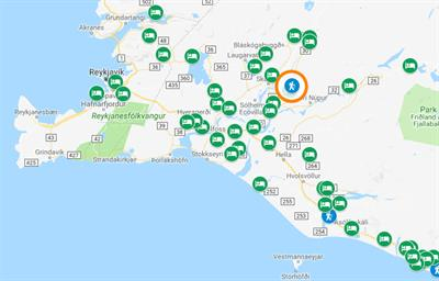
- Location: Mt. Midfell
- GPS Coordinates: 64.1189380, -20.3176
- Region: South
- Duration: 2 hours
- Difficulty: Medium
- Distance: 4418m
- Height: 101m
- Increase: 173m
Miðfell is the closest mountain to the town of Flúðir, a small but distinctive peak that gives the area all its character. Up there you will find an impressive lake, Fjallsvatn, and all the soothing lake sounds and scenes you needed. On a clear day, it is possible to see all the way to Jarlhettur mountain ridge and glacier Langjökull.
2. SELJALANDSFOSS AND GLJÚFRABÚI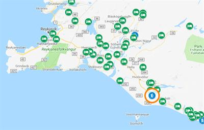
- Location: Seljalandsfoss
- GPS Coordinates: 63.6152980,-19.9937
- Region: South
- Duration: 1,5 hours
- Difficulty: Easy
- Distance: 2246m
- Height: 78m
- Increase: 23m
Begin your exploration of the South Coast with an exciting 2-for-1 waterfall chase. Venture yourself behind the mesmerizing Seljalandsfoss whose drizzle might get you slightly wet, for a unique perspective of the waterfall. Visit its equally beautiful neighbour, Gljúfrabúi, nestled in a mossy crevasse.
3. HELLUR NEAR REYNISFJARA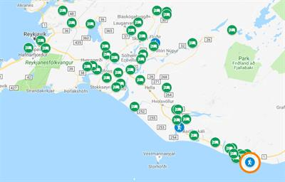
- Location: Hellur
- GPS Coordinates: 63.4044500,-19.0456
- Region: South
- Duration: 2 hours
- Difficulty: Medium
- Distance: 1725m
- Height: 7m
- Increase: 12m
A short walk from Reynisfjara Black Beach on Hellnar Peninsula, where you can sneak in various caves once used by the famous fire priest Jón Steingrímsson and his family as they lived there in the mid-18th Century. Enjoy spectacular views and step back in time with the Living Room Cave and the protected archaeological finds on-site.
4. ÁSTARBRAUTIN (THE LOVE TRAIL)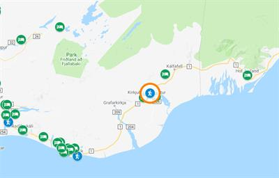
- Location: Kirkjubæjarklaustur
- GPS Coordinates: 63.793,-18.041900
- Region: South
- Duration: 2 hours
- Difficulty: Medium
- Distance: 4100m
- Height: 38m
- Increase: 135m
Follow the beautiful and romantic Ástarbrautin trail – ást meaning love – just above the town of Kirkjubæjarklaustur. Get priceless views over Landbrotshólar, the most extensive area of pseudocraters in Iceland, and get real close to Systrafoss (Sisters‘ Waterfall) and Systravatn (Sisters‘ Lake).
5. HJALLANES CIRCLE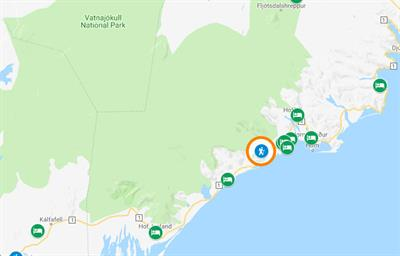
- Location: Hjallanes
- GPS Coordinates: 64.2479670,-15.6866
- Region: South
- Duration: 2,5 hours
- Difficulty: Medium
- Distance: 8100m
- Height: 33m
- Increase: 143m
Follow the Hjallanes hiking route, a splendid area that used to be entirely covered by Skálafellsjökull Glacier some hundred years ago. In Autumn and Spring, observe wildlife up close in their natural habitat, including reindeers and Arctic foxes, Iceland‘s only native mammal. In Summer, enjoy the rich birdlife!
NORTH ICELAND
Read all about our hiking routes in the North!
1. KOLUGLJÚFUR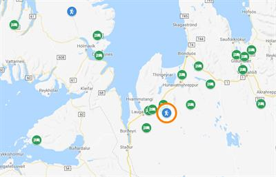
- Location: Kolugljúfur
- GPS Coordinates: 65.332775,-20.570097
- Region: North
- Duration: 0,5 hour
- Difficulty: Medium
- Distance: 1417m
- Height: 185m
- Increase: 10m
Walk into the giantess Kola‘s den and explore Kolugljúfur, where the waters flow peacefully downwards to suddenly plunge into the gorge, forming the impressive Kolufossar Falls. You can either admire the view from up high the bridge or stand closer to the waterfall... with caution always!
2. MÆLIFELLSHNJÚKUR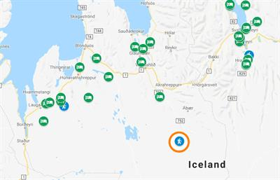
- Location: Mælifellshnjúkur
- GPS Coordinates: 65.390327,-19.352975
- Region: North
- Duration: 3,5 hours
- Difficulty: Medium
- Distance: 7277m
- Height: 462m
- Increase: 713m
Conquer Mælifellshnjúkur, the tallest mountain (1.138m) of the Western part of Skagafjörður region, a gentle but high summit. From the top, enjoy panoramic views over 10 of the 23 districts of the country! A relatively easy but somewhat long hike to a view you won‘t forget.
3. STAÐARBYGGÐAFJALL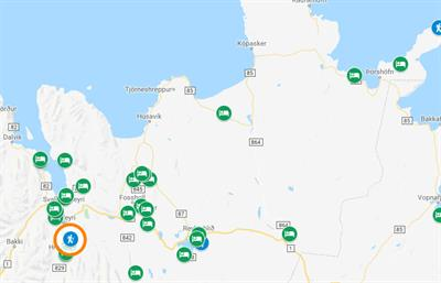
- Location: Staðarbyggðafjall
- GPS Coordinates: 65.5946780,-18.0084
- Region: North
- Duration: 3,5 hours
- Difficulty: Medium
- Distance: 9402m
- Height: 236m
- Increase: 776m
A comfortable hike up Mt. Staðarbyggðafjall, with gradual elevation. The view over the mouth of the fjord Eyjafjörður and the surrounding mountain ranges is hard to put in words, but spectacular seems accurate. A vibrant green panorama in Summer, and a pure white wonderland in Winter!
4. HVERFJALL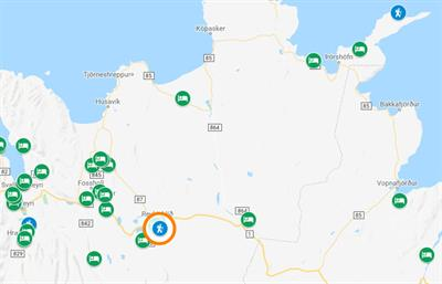
- Location: Mt. Hverfjall (Hverfell)
- GPS Coordinates: 65.6129130,-16.8758
- Region: North
- Duration: 2.5 hours
- Difficulty: Medium
- Distance: 4358m
- Height: 286m
- Increase: 165m
Unveil the secrets of Mt. Hverfjall, one of Iceland‘s most remarkable volcanos. Walk up to its rim, and get rewarded with infinite views over Lake Mývatn area, from its fumaroles and vast lava fields, to blue geothermal pools and visible rifts. Feel the Earth beating, litterally!
5. ALDEYJARFOSS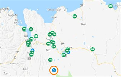
- Location: Aldeyjarfoss
- GPS Coordinates: 65.3643260, -17.3415
- Region: North
- Duration: 0.5 hour
- Difficulty: Medium
- Distance: 1119m
- Height: 413m
- Increase: 38m
Visit Aldeyjarfoss, one of Iceland‘s most photographed waterfalls, and understandably so. Aldeyjarfoss plunges down over 20 meters into a restless cauldron of water, whose vivid blue is a stark contrast with the surrounding black basalt columns and white foam.
EAST ICELAND
Read all about our hiking routes in the East!
1. SKORUVÍK AND SKÁLAR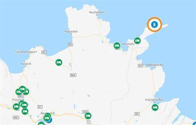
- Location: Skoruvík and Skálar
- GPS Coordinates: 66.3593570,-14.7603
- Region: East
- Duration: 3 hours
- Difficulty: Medium
- Distance: 12539m
- Height: 7m
- Increase: 70m
Take a hike through a once thriving fishing village, whose ruins are still visible. Enjoy the first birdwatching platform of its kind in Iceland, extending some 10 meters out from the cliff, for a spectacular and privileged observation of the seabird colonies. Northern Gannet, Kittiwake, Northern Fulmar, Puffin, Razorbill, Guillemot to name a few!
2. STÓRURÐ (GIANT BOULDERS)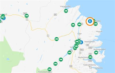
- Location: Stórurð
- GPS Coordinates: 65.5650300,-14.0023
- Region: East
- Duration: 4 hours
- Difficulty: Medium
- Distance: 12367m
- Height: 396m
- Increase: 438m
Get off the beaten tracks to explore Stórurð, one of Iceland‘s most underrated places. A chaotic jam of gigantic tuff boulders, grassy meadows with a radiant display of flowers, scenic little tarns, towered by majestic mountains, of which Mt. Dyrfjöll proudly dominates. Do you picture yourself there yet?
3. FARDAGAFOSS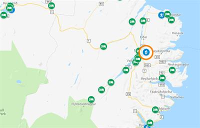
- Location: Fardagafoss
- GPS Coordinates: 65.268079,-14.332743
- Region: East
- Duration: 1 hour
- Difficulty: Medium
- Distance: 2003m
- Height: 144m
- Increase: 148m
A short there-and-back hike to Fardagafoss, the top one of three gem waterfalls fed by Miðhúsaá River, the other two being Gufufoss and Folaldafoss. The plume and the shapes of the fractured rocks reveal an extraordinary place of contrasts and textures. There is a cave behind Fardagafoss, accessible with an overhang protecting the entrance.
4. WHITE SANDS BY DJÚPIVOGUR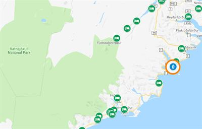
- Location: Djúpivogur
- GPS Coordinates: 64.6557,-14.282100
- Region: East
- Duration: 1.5 hours
- Difficulty: Easy
- Distance: 2965m
- Height: 9m
- Increase: 14m
Enjoy the vast wilderness of the striking Eastfjords with this trail along Langitangi. In Summer, the area is teeming with moorland birds, ducks and seabirds that will delight ornithologists and bird enthusiasts alike. The prominent Mt. Búlandstindur is a sight to behold, being the symbol of the Djúpivogur County. A good option for families and children traveling in Iceland.
WEST ICELAND
Read all about our hiking routes in the West!
1. FOLLOW IN THE OLD FOOTSTEPS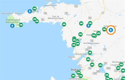
- Location: Húsafell
- GPS Coordinates: 64.6992450,-20.8701
- Region: West
- Duration: 1.5 hours
- Difficulty: Medium
- Distance: 3084m
- Height: 127m
- Increase: 67m
Follow in the Old Footsteps of Snorri Björnsson, one of Húsafell‘s most famous inhabitants, a priest who has inspired countless stories, and a living legend from the 18th Century. Renowned for its strength, Snorri‘s prowess can be seen all along the trail. Test your strength with the The Húsafell Stone, once used to close the pen!
2. GLANNI WATERFALL AND PARADISE POOL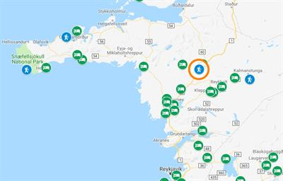
- Location: Glanni
- GPS Coordinates: 64.753811,-21.547408
- Region: West
- Duration: 1 hour
- Difficulty: Easy
- Distance: 1754m
- Height: 169m
- Increase: 128m
Embark on a family-friendly hike across Grábrókarhraun lava field, to reach the peaceful and inspiring oasis of Glanni Waterfall. What Glanni lacks in size, it surely makes up for in beauty, and the Paradise Pool lives up to its name, with the clearest deep-blue water you could ever dream of.
3. DJÚPALÓN AND DRITVÍK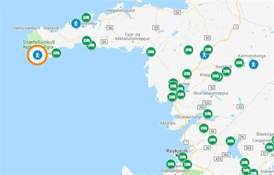
- Location: Djúpalón
- GPS Coordinates: 64.7537780,-23,8946
- Region: West
- Duration: 1,5 hours
- Difficulty: Medium
- Distance: 2536m
- Height: 85m
- Increase: 28m
Where lava meets the sea! Experience the dramatic scenery of Djúpalón and Dritvík, and their series of rocky sea stacks emerging from the ocean. Whether your desire is to see fine black sand beaches, freshwater lagoons, lava arches or shipwrecks, this hike has it all.
4. BRIMLÁRHÖFÐI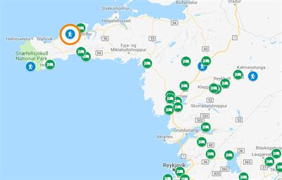
- Location: Brimlárhöfði
- GPS Coordinates: 64.9441540,-23.3590
- Region: West
- Duration: 2 hours
- Difficulty: Medium
- Distance: 5790m
- Height: 12m
- Increase: 234m
Although its neighbour Mount Kirkjufell clearly steals the show, Mount Brimlárhöfði offers a different perspective of the Arrowhead Mountain, and fabulous wide open views over the surroundings, all the way to Breiðafjörður Bay. A fun and relatively easy hike on Snæfellsnes Peninsula!
WESTFJORDS
1. BREIÐAVÍK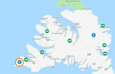
- Location: Breiðavík
- GPS Coordinates: 65.543557,-24.366249
- Region: Westfjords
- Duration: 2 hours
- Difficulty: Easy
- Distance: 6376m
- Height: 44m
- Increase: 25m
Only 12 km from the popular Látrabjarg cliffs, lies the creek of Breiðavík and its glorious Golden beach. Walk down to the beach and you will see how the wind has blown the sand all the way to the mountaintops at each end of the beach. In the evening, witness the most incredible sunset in the vicinity of puffins!
2. HEYDALUR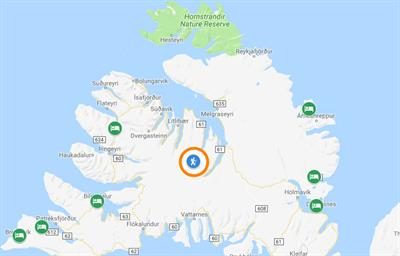
- Location: Heydalur
- GPS Coordinates: 65.8438990,-22.6800
- Region: Westfjords
- Duration: 3,5 hours
- Difficulty: Medium
- Distance: 10320m
- Height: 44m
- Increase: 434m
Enjoy an active day in the Icelandic mountains by hiking down Heydalur Valley in the Westfjords, one of Iceland‘s oldest parts from a geological point of view. Walk up majestic slopes and back along the ridges, until you reach Bæjargil Canyon. A place of sheer beauty and tranquillity. After the hike, relax in outdoor hot springs!
Before you hop on one of these epic hikes, make sure to check the Essentials to Pack for a Hiking Trip and Things to Know Before a Hiking Trip in Iceland!